
In this article
You already know the silhouette. That jagged granite skyline sits on a clothing logo and half the climbing photos you’ve ever double-tapped, which makes it easy to assume you know the mountain. What the search results blur together is that most people typing “climbing Fitz Roy” are really headed for the day hike to the viewpoint, while climbing the peak itself is a multi-day technical alpine ascent that turns back strong, experienced parties routinely. This guide covers the real thing: the routes, why the grades lie, the approach, the season and permits, and the blunt question of who’s actually ready.
Trekking to See Fitz Roy vs. Actually Climbing It
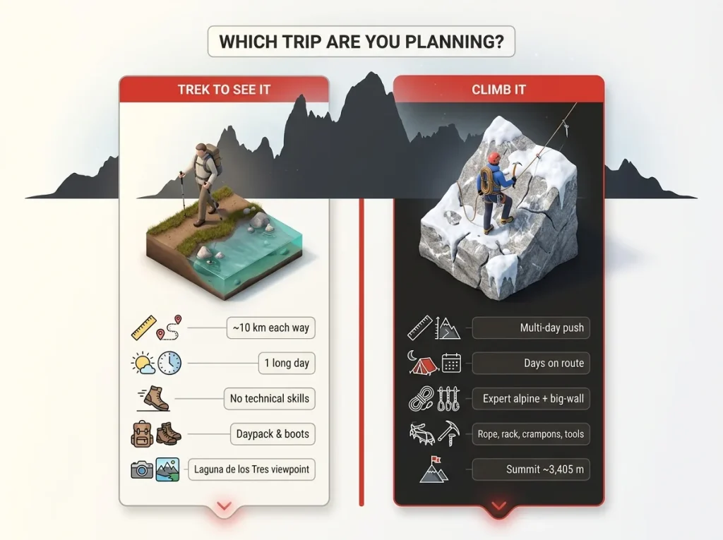
Before you read another word, sort out which trip you’re actually planning, because the internet keeps welding these two together and they share nothing but a view. One is a day hike. The other is a serious alpine climb. Getting them confused wastes weeks of planning and, occasionally, gets someone in over their head.
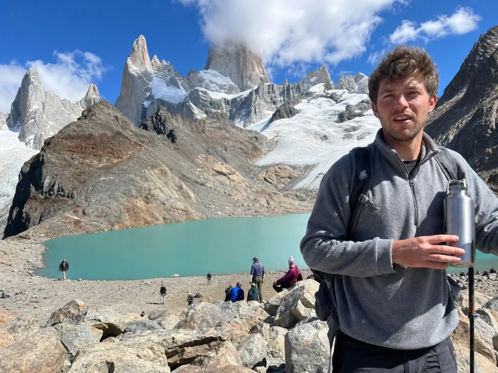
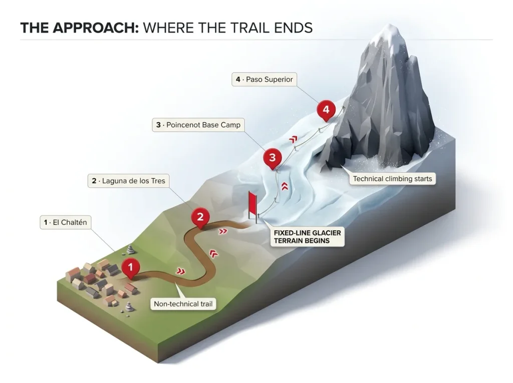
The trek is straightforward. From El Chaltén you walk roughly 10 kilometers each way to Laguna de los Tres, the classic viewpoint where the tower reflects in a cold glacial pool.
No ropes, no glacier skills, no technical anything. A fit hiker knocks it out in a long day, with side trips to Laguna Capri and Laguna Sucia if the legs feel good. If that’s the trip you came for, you’re in good company, and honestly this is the answer for the overwhelming majority of people who search this mountain’s name.
Climbing Fitz Roy starts where that trail ends and then keeps going for days. You move past the viewpoint to the Poincenot base camp, up fixed lines through glacier terrain to an advanced camp at Paso Superior, and only then do you start climbing the rock. It’s the difference between a non-technical walk-up and a true technical objective, the same gap that separates a fit tourist from an alpinist. If you want a sense of how a genuinely non-technical high peak reads by comparison, the honest breakdown of a walk-up like Aconcagua’s standard route makes the contrast obvious.
Locals will tell you to budget five days in El Chaltén just to catch one clear view of the peak. The mountain hides in cloud most of the time. If you’re coming purely to see it, build in slack days, or you’ll leave with photos of grey soup.
Where Fitz Roy Is and Why It Looks the Way It Does
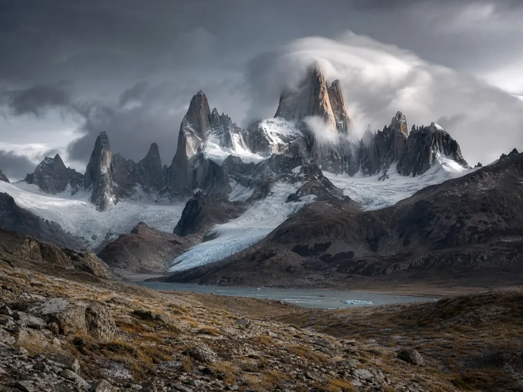
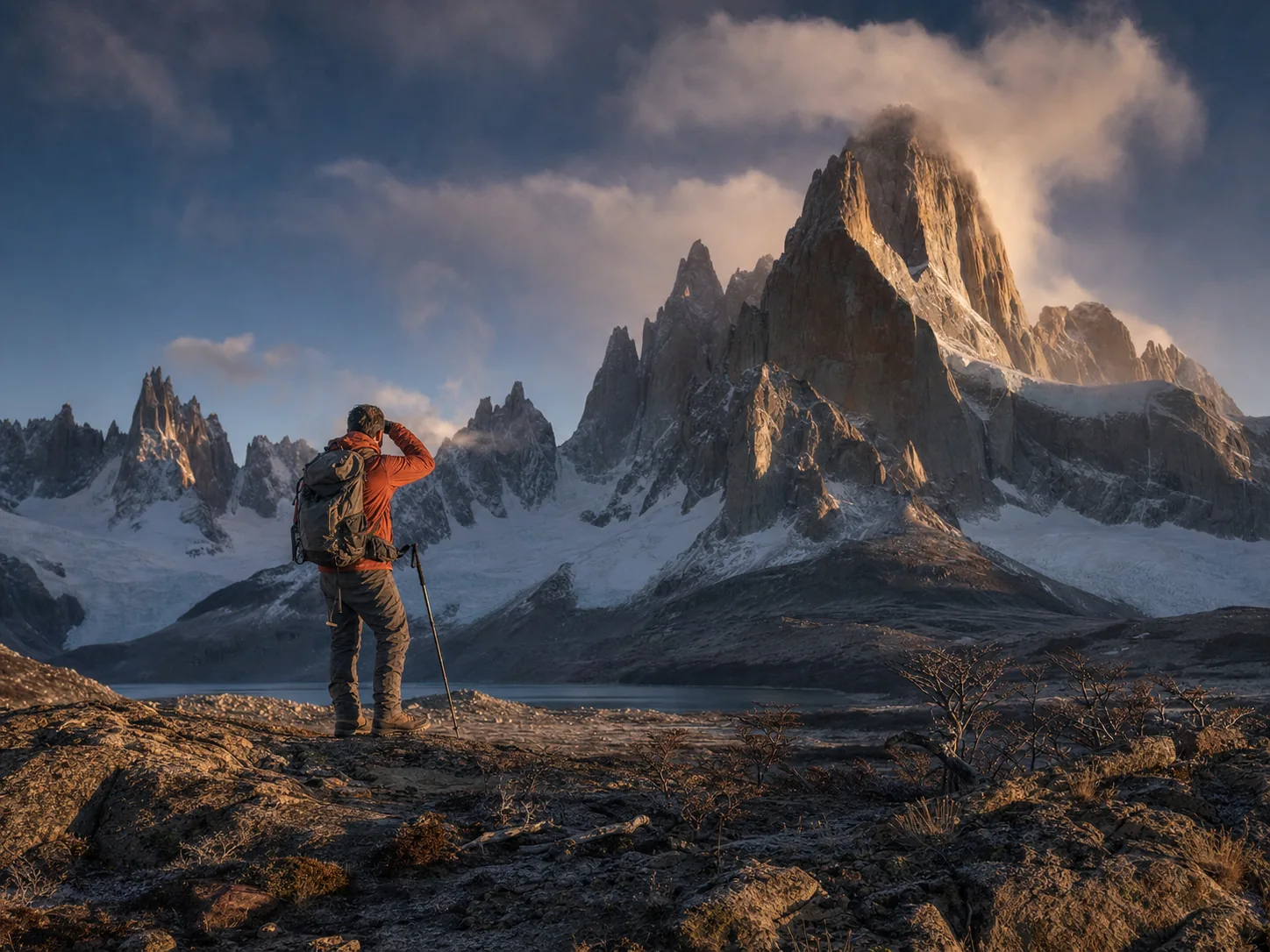
That skyline ended up on a clothing logo for a reason, and the same features that make it photogenic make it brutal to climb. Fitz Roy sits in Santa Cruz Province, Argentina, inside the country’s Los Glaciares National Park, a UNESCO World Heritage Site perched on the eastern edge of the Southern Patagonian Ice Field. The hub for everything is El Chaltén, a scrappy trekking town founded in 1985 that’s still one of Argentina’s youngest settlements.
The rock is the whole story. Fitz Roy granite is a Miocene intrusion, roughly 12 to 18 million years old, that glaciers carved into clean vertical crack systems and sheer walls. It’s superb stone with almost no easy angles anywhere on it. That’s great for the climbing quality and merciless for anyone hoping to find a casual way up.
Then there’s the weather, written right into the name. The smoking mountain cloud cap forms because the Southern Ocean storm track slams straight into the massif with nothing to slow it down. That cloud isn’t a photo-op, it’s the weather system climbers read from town before committing.
Fitz Roy also stands among neighbors, not alone: the spire of Poincenot sits below it and its even more notorious neighbor, Cerro Torre, rises just across the valley. The famous 2014 Fitz Traverse linked seven summits of this massif in a single push, which tells you how much serious terrain is packed into one skyline. And though it tops out around 3,405 meters, it feels bigger, because the base sits low and you climb nearly the full vertical relief instead of starting from a high plateau.
The First Ascent and How the Routes Were Pioneered
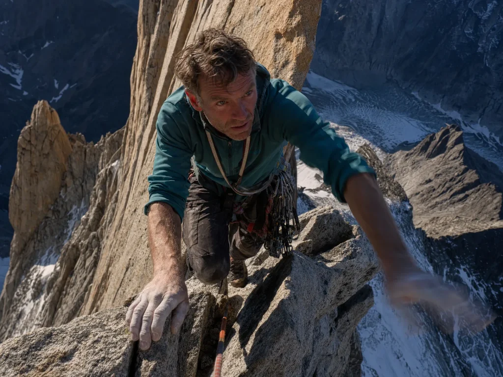
Understanding how the first team got up this thing explains why the “standard” route is still no gift. On February 2, 1952, French climbers Lionel Terray and Guido Magnone established the Franco-Argentine route up the Southeast Ridge. It was a multi-day aid siege on cold, occasionally crumbly granite with the gear of the era, and that same line is still the least-hard way to the top today.
Sit with that. The easiest route on the mountain was a landmark achievement 70 years ago and remains a committing climb now.
The second ascent didn’t come until 1965, and it went a completely different way: up the Supercanaleta, a long direct couloir, climbed by Argentine climbers in roughly two and a half days. Thirteen years between the first and second ascents, by two totally independent lines, hints at how many separate routes this one peak actually holds.
The name itself has a story. The mountain was rechristened “Fitz Roy” in 1877 by explorer Francisco Pascasio Moreno, after Robert FitzRoy, captain of HMS Beagle. The older Tehuelche name, Chaltén, predates all of that.
In recent years the peak has drawn headline solo and speed ascents, including Jim Reynolds’ 2019 free solo up and back down the Franco-Argentine, and the big-wall free climbing that defines routes like El Capitan’s Freerider has fed the same rising standard. Read those outlier ascents as what they are: performances by full-time professional alpinists, not benchmarks for a strong weekend party.
The Main Routes and Grades, Line by Line
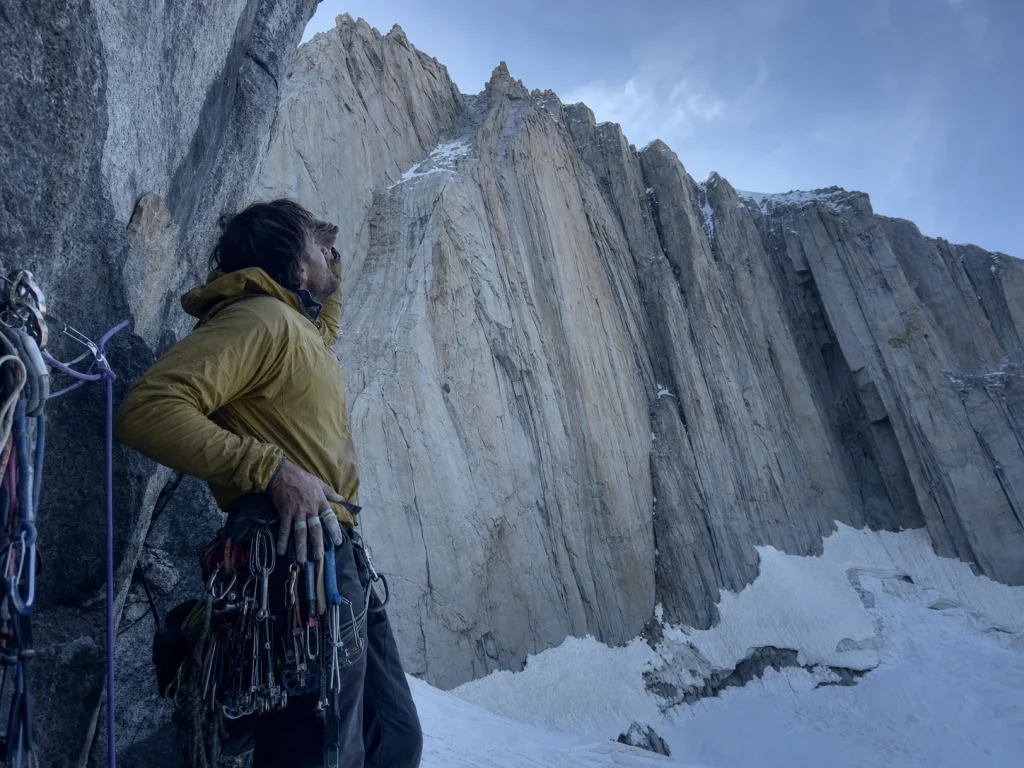
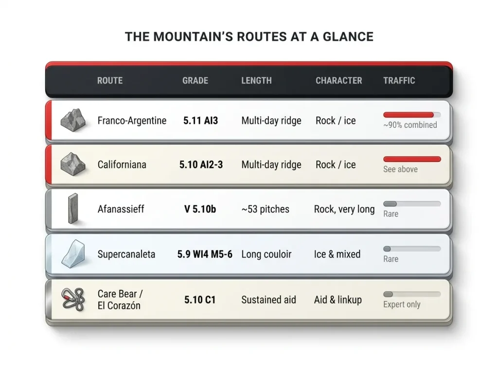
Here’s the menu, and here’s what each line actually asks of you beyond the number on the topo. Roughly 90 percent of all Fitz Roy ascents go up one of two routes, and the rest scatter across a handful of much more committing lines.
The Two Lines Almost Everyone Climbs
The Franco-Argentine (Southeast Ridge) is the standard, sitting around 5.11 and AI3 depending on conditions and the source. The Californiana, or Californian route, runs about 5.10a/b with AI2-3 ice. Together these two absorb the vast majority of traffic, and for good reason: they’re the most reasonable combinations of length, difficulty, and retreat options on the peak. “Most reasonable” still means multi-day technical alpine climbing with real fall consequences.
The Long and the Steep
The Afanassieff (Northwest Ridge) carries a modest-looking guidebook grade of around V 5.10b, but it’s 1,550 meters and roughly 53 pitches, one of the longest routes in the entire range, first climbed in 1979. The Supercanaleta goes at 5.9 WI4 with M5-6 mixed climbing, a classic ice-and-mixed couloir with a very different character from the ridge lines. The way a named alpine route’s real demands can dwarf its grade is a pattern worth internalizing before you pick an objective, and the same disconnect shows up on more accessible peaks like the Grand Teton’s Owen-Spalding route.
The Hard End
At the committing end sit lines like the Care Bear Traverse and El Corazón (5.10 C1), where aid, linkups, and sustained difficulty stack up fast. If you’re eyeing anything past the two standard routes, understand that you’ve stepped into a much smaller, much more serious minority of climbers on this mountain.
Why the Guidebook Grades Lie
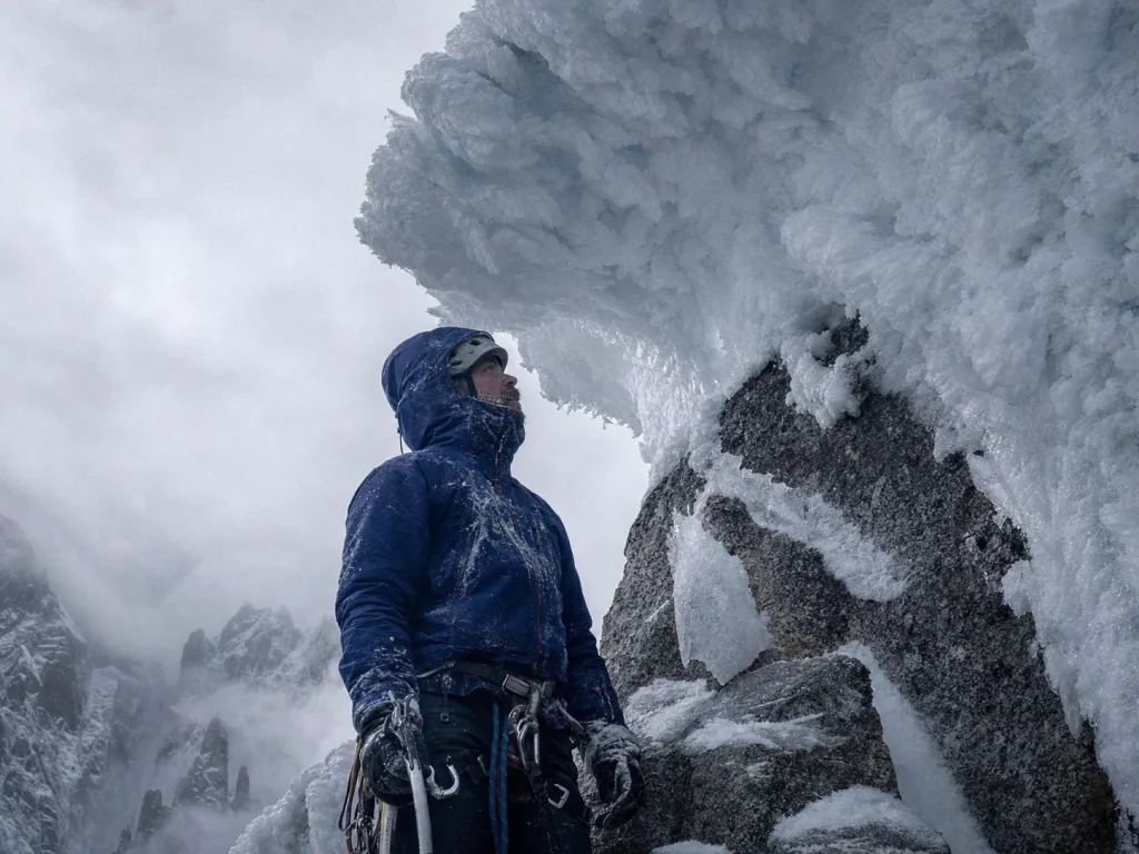
If you take one thing from this guide, take this: on Fitz Roy, don’t trust the number on the topo. The grade tells you about the hardest single move. It says almost nothing about the length, the route-finding, the retreat, or the rime, which is where these routes actually chew people up.
The cleanest proof comes from the Afanassieff. As documented by climber-historian Rolando Garibotti, Roger Schäli, an accomplished alpinist with nothing to prove, publicly admitted he badly underestimated the route, comparing its scale to the Peuterey Ridge on Mont Blanc, one of the great long routes of the Alps. That’s a 6a+ grade on paper behaving like something two or three times bigger in reality. Generalize it into a working rule: treat every Fitz Roy route as longer, slower, and harder to escape than its grade implies, and plan your time and your bail options accordingly. A grade that undersells the true skill bar isn’t unique to Patagonia, and you’ll see the same trap on a route like the East Face of Mt. Whitney, where the modest number hides a real jump in commitment.
Then there’s the rime. The summit and windward faces build up rime mushrooms, bulbous accretions of ice that form over multiple weather cycles and bond only loosely to the rock beneath. The rime-ice buildup that caps exposed summits like this one is studied as its own mountaineering hazard, and for good reason: the final feature blocking the top of nearly every route isn’t clean rock or a fixed grade of ice, it’s an unstable cap you have to assess on the spot, every single time.
Conditions also shift within one season, not just between seasons. Colin Haley’s accounts describe the climbing varying wildly pitch to pitch on the same route, some sections choked with slow rime, others nearly bare rock and fast. The practical takeaway is to plan for a variable pace instead of a fixed time estimate. The parties that get caught out are almost always the ones who read the topo grade, assumed a tidy schedule, and under-planned both time and retreat.
When you research a Fitz Roy route, ignore the headline grade first and read trip reports for two things instead: how long the route actually took real parties, and how hard it was to retreat from partway up. Those two numbers predict your day far better than the 5.10 or 5.11 on the topo.
Access, Approach, and Base Camps from El Chaltén
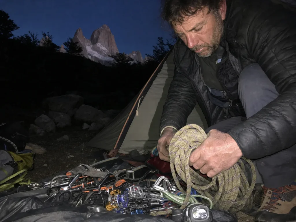
The climb starts long before the climbing does, and the ground you cover to even touch the rock is a real part of the objective. Everything runs through El Chaltén, where you register your climb, resupply, and watch the forecast for a window.
El Chaltén and the Trailhead
El Chaltén is small, walkable, and built around exactly this. You’ll find the trailheads, the park report center, and enough services to stage from town for days while you wait. This is also where the trek and the climb share ground for a while: the same trail that carries day hikers toward Laguna de los Tres carries climbers toward the base of the mountain.
Base Camps and the Glacier Approach to Paso Superior
Past the hiking terrain, the approach chain runs from town up the Río Blanco valley to the Poincenot base camp, then up fixed lines through glacier terrain to Paso Superior, the advanced base camp where technical climbing begins. All told you gain somewhere around 9,710 vertical feet across the approach and the route combined. This is where alpine skills become non-negotiable, because glaciated terrain and fixed-line travel are the price of admission before you ever touch the granite, the same kind of glacier-approach planning a serious alpine objective demands, whether it’s Fitz Roy or a technical line in the North Cascades. The video above walks through what that approach and the lower fixed-line terrain actually look like on the standard route.
Season, Weather Windows, and Permits
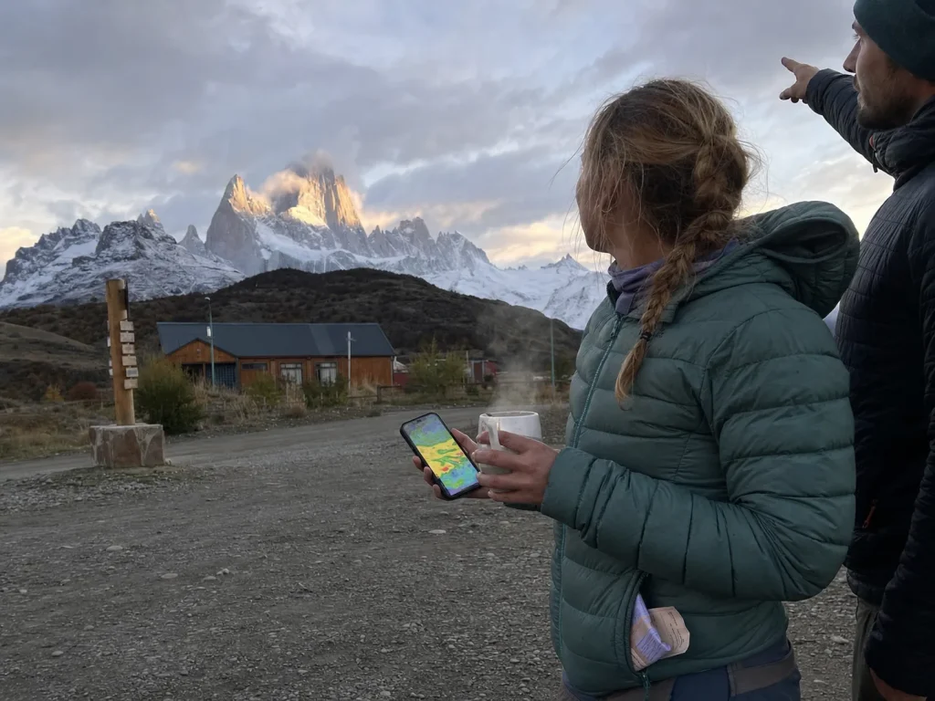
On most peaks weather is a variable. On Fitz Roy it’s the variable, and learning how climbers play the window is more useful than any packing list.
Season and the Weather-Window Game
The climbing season is the austral summer, roughly November through March, with most attempts falling between December and February. What decides success isn’t altitude, it’s the Southern Ocean storms, and the mountain is genuinely climbable only a handful of days in a season.
Modern mountain forecasting changed the game: instead of establishing high camps and hoping, climbers now base out of town and commit only when the models predict a window. The catch is that forecasting inside the Fitz Roy massif is still less reliable than in better-instrumented ranges, because there’s sparse local weather data to feed the models. That gap is exactly why strong, well-prepared parties still turn back, and it’s the same conditions-and-readiness checkpoint that decides summit day on peaks like the Matterhorn.
Time your push through the bergschrund and the lower gullies for the cold hours, not midday. As the sun hits the walls above, ice and rime melt loose and come down. Climbers on the Supercanaleta have reported getting showered exactly there. Move through it early, then let the day warm the rock higher up.
Registration, Permits, and Park Rules
The bureaucratic step is real but low-friction. You register your climbing objective for free with Argentina’s national parks administration at the park report center in El Chaltén. There’s no fee for a non-commercial climb, but you can’t skip the registration. On top of that, you’re inside Los Glaciares National Park, so Leave No Trace and permitted-camping-only rules apply throughout. It costs nothing and takes little time, so just do it properly.
Gear, Skill Prerequisites, and Who Should Actually Attempt This
This is the blunt conversation the search results won’t have with you: what you carry, what you need to already climb at, and whether you’re ready. The anti-sell rule applies here too, so where gear won’t fix the problem, the honest answer is skill and experience, not a purchase.
The Gear That Actually Matters
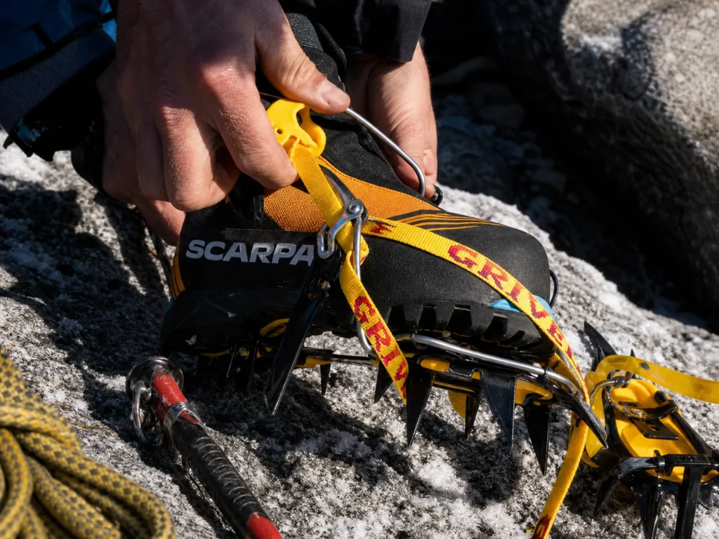
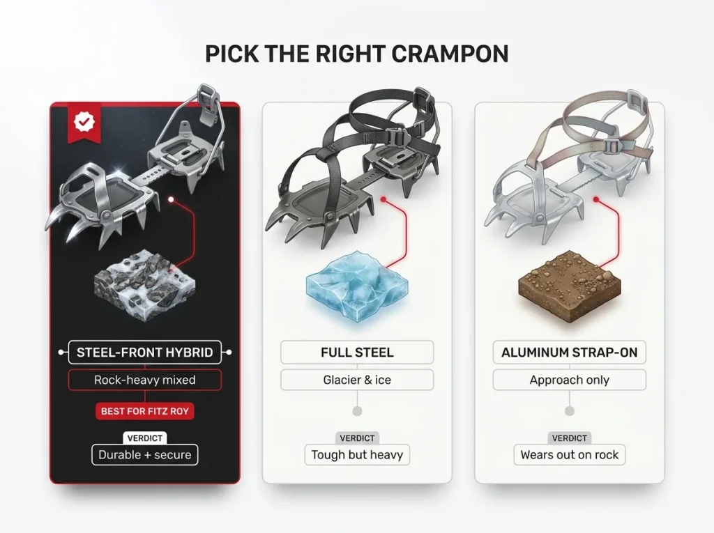
Start with crampons, because this is where generic advice fails people. Fitz Roy is rock-heavy mixed terrain, so you want steel or steel-front hybrid crampons, not aluminum strap-ons that wear out fast against granite and leave you underequipped on the mixed pitches. A semi-automatic steel hybrid like the Grivel G12 New Matic hits the sweet spot: durable points that survive rock, and a secure binding for technical moves. If you want a proven step down in price without dropping to aluminum, the Black Diamond Sabretooth covers the same mixed-terrain job with a clip-style hybrid binding.
Your tools matter just as much. The mixed, rime-armored pitches call for a technical, aggressively curved ice tool rather than a straight general-mountaineering axe, which is a category distinction worth getting right: a walking axe will leave you fighting the steep sections.
Round out the rack with a helmet, ice screws for the water-ice sections, and a set of cams and nuts for rock protection on the granite pitches. For the rope work, an ultralight alpine harness like the Petzl Altitude keeps bulk down over long big-wall and multi-pitch days. And for your feet, integrated double mountaineering boots such as the Scarpa Phantom 6000 (men’s · women’s) handle the sustained ice, mixed ground, and cold exposure of the upper routes.
The Skill Bar and Who’s Actually Ready
Nobody in the search results will tell you plainly, so here it is. To attempt Fitz Roy you should already be comfortable leading multi-pitch trad and alpine rock at grade, with real big-wall and aid mileage behind you, prior serious alpine objectives in the bank, and solid self-rescue competence. This isn’t a first alpine climb or a step up from the gym.
Parties who show up under-qualified don’t get an easier version of the mountain, they get weather-trapped high on committing terrain with no realistic rescue coming. To see where Fitz Roy sits among the world’s benchmark peaks and their standard routes, it belongs firmly in the expert tier, alongside objectives that assume you’ve already done the work.
The Safety Line You Can’t Cross
Self-reliance here isn’t a virtue, it’s the entry fee. Rescue high on the peak is effectively unavailable, so you and your partner are the entire safety system. That means the basics can’t be shaky.
Solid anchors, dialed-in self-arrest, and the ability to survive an unplanned night out are assumed, not optional. If any of that is wobbly, the mountain will find it. Understanding why steel and hybrid crampons hold where aluminum fails on mixed terrain is the easy part; building the bivvy competence that keeps a weather-trapped party alive is the part that actually saves you when a window slams shut.
Conclusion
Three things to carry out of here. First, trekking to see Fitz Roy and climbing it are different sports, so figure out honestly which trip you’re planning before you spend a dollar. Second, trust the mountain, not the topo, because every line is longer and harder to escape than its grade lets on. Third, weather and self-reliance, not altitude, decide who stands on top.
If the climb is genuinely your goal, the best next move isn’t booking a flight, it’s getting honest about the skill bar and going to build alpine mileage on smaller, lower-consequence objectives first. Fitz Roy rewards the prepared and quietly punishes the hopeful. Earn it on other peaks, then come back for this one.
Frequently Asked Questions
01How hard is it to climb Cerro Fitz Roy?
Very hard. Even the least-hard line, the Franco-Argentine route, is a multi-day technical alpine climb up to roughly 5.11 and AI3, with serious fall consequences. It demands expert big-wall, mixed, and self-rescue skills, and weather turns back strong parties routinely.
02What is the easiest route up Fitz Roy?
The Franco-Argentine route on the Southeast Ridge, the 1952 first-ascent line, is the standard and least-hard way up. Least-hard is not easy here, though. It is still a committing multi-day climb, and about 90 percent of ascents use it or the Californiana.
03Can you hike to Fitz Roy without technical climbing skills?
Yes. The roughly 10-kilometer trek from El Chaltén to the Laguna de los Tres viewpoint is a non-technical day hike any reasonably fit person can do. Reaching the viewpoint requires no ropes or glacier skills. Climbing the peak itself is a completely different, expert-only undertaking.
04Do you need a permit to climb Fitz Roy?
You register your climbing objective for free with Argentina’s national parks administration at the park report center in El Chaltén. There is no fee for a non-commercial climb, but the registration is mandatory. Los Glaciares National Park rules and Leave No Trace also apply.
05How long does it take to climb Fitz Roy?
Plan for weeks, not days. Climbers often wait in El Chaltén for a rare weather window, then commit to a fast multi-day push once conditions align. On route the pace varies pitch to pitch with rime and ice, so a fixed time estimate is unreliable.
Safety Notice: Rock climbing and mountaineering are inherently high-risk
activities that can involve physical trauma or fatal incidents. The information on Rock Climbing Realms is for
educational and informational purposes only. Techniques and advice presented here are not a substitute
for professional, hands-on instruction. Conditions and risks vary by location. Always seek guidance
from a qualified instructor before attempting new techniques. By using this website, you agree that you
are solely responsible for your own safety. Any reliance you place on this information is strictly
at your own risk, and you assume all liability for your actions. Rock Climbing Realms and its authors
will not be held liable for any harm, damage, or loss sustained in connection with the use of this information.
Affiliate Disclosure: We are a participant in the Amazon Services LLC Associates Program, an
affiliate advertising program designed to provide a means for us to earn advertising fees by advertising and linking
to Amazon.com. As an Amazon Associate, we earn from qualifying purchases. We are also an official affiliate partner
of Black Diamond Equipment via the AvantLink network. If you click on a Black Diamond affiliate link and make a
purchase, we may earn a commission at no additional cost to you. We also participate in other affiliate programs.
Additional terms are found in the terms of service.