
In this article
Ask ten people where Mount Everest is and you’ll get Nepal, China, and a surprising number of confident votes for India. Here’s the thing none of those answers gets fully right: the summit sits on an international border, so the mountain genuinely belongs to two countries at once. Orient enough first-timers toward the Khumbu and the same three confusions come up every time, and the country mix-up is the smallest of them. By the end of this you’ll know the exact country, range, coordinates, and height, plus how to actually find Everest on a map and why the tallest mountain on the planet hides in plain sight.
Which Country Is Mount Everest Actually In
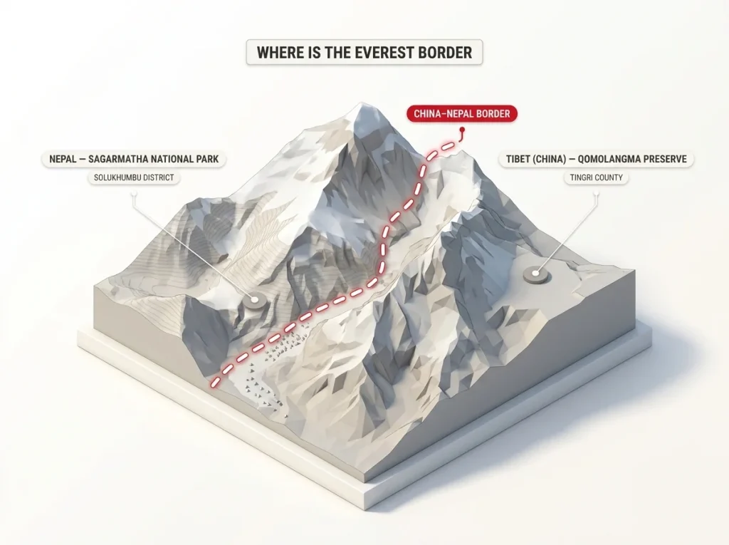
The honest answer is both. The China–Nepal border runs right across the summit point, so the south slope falls in Nepal and the north slope falls in Tibet, which is part of China. Stand on top and one boot is in each country. That’s not a technicality anyone invented to be cute, it’s how the line was drawn, and it’s why “which country owns Everest” never has a clean one-word answer.
The border that splits the summit
Picture the summit as a high ridge of snow with a line drawn over the very top. Everything draining south toward the Khumbu valley is Nepal, in the Solukhumbu District. Everything draining north toward the Tibetan Plateau is China. The border doesn’t run around the mountain, it runs over it, which is a detail most maps draw so faintly that people miss it entirely.
Why climbers say “south side” or “north side”
Spend any time around people who’ve actually been there and you’ll notice they almost never argue about countries. They say south side or north side instead. It’s faster, and it sidesteps a political question nobody at the trailhead wants to relitigate. South side means Nepal and the trek through the Khumbu; north side means Tibet and the drive-in from Lhasa. The slope you pick decides almost everything else about the trip.
The short version for anyone skimming
Nepal and China share Everest, split down the summit. It is not in India, even though that guess is more common than you’d expect. We’ll get to why people make that mistake, because the reason is more reasonable than it sounds.
Everest’s Place in the Himalayas and Its Coordinates
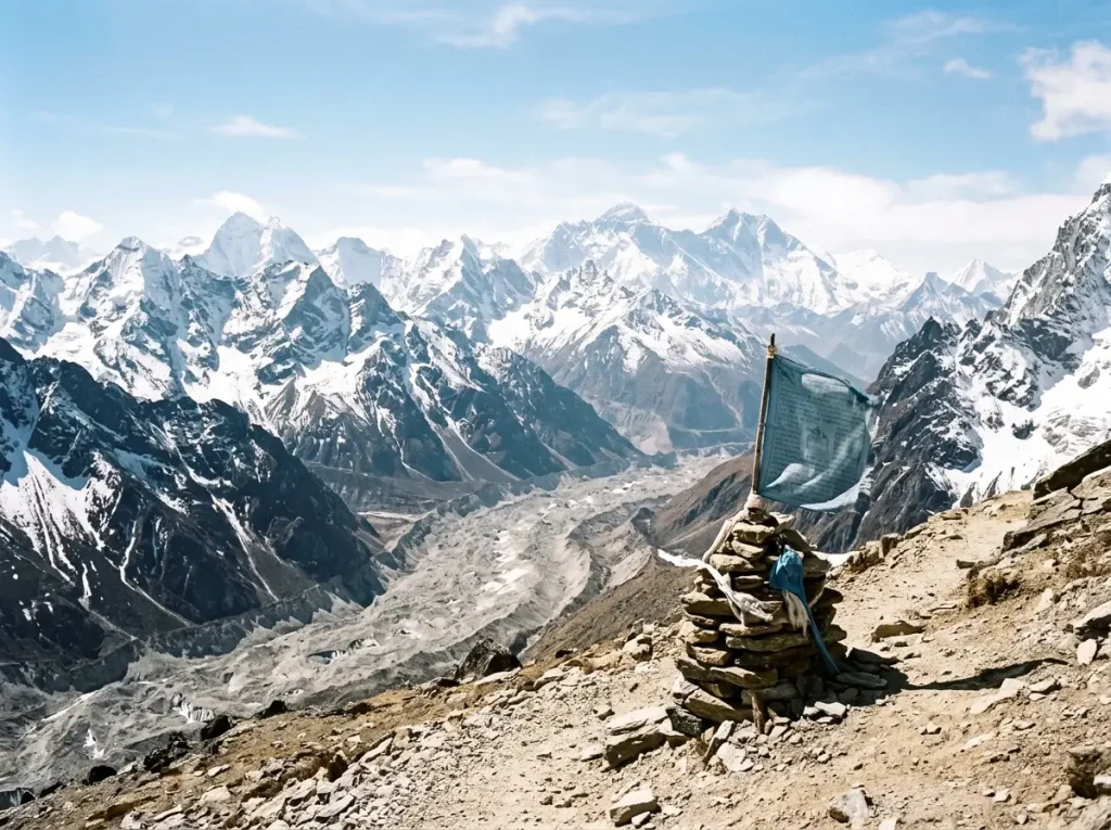
Zoom a map pin in slowly and you get a cleaner picture than “somewhere in Asia.” The Himalayas stretch across five countries, but Everest sits in one specific pocket of them, and pinning that pocket is the difference between a vague gesture and an actual location.
The Himalayas versus the Mahalangur Himal
The Himalayas are the whole range. The Mahalangur Himal is the sub-range that holds Everest and several of its giant neighbors. If the Himalayas are the address’s city, the Mahalangur Himal is the street. Most articles stop at “the Himalayas,” which is a little like saying a house is “in Texas” and calling it directions.
The coordinates that land you on the summit
The summit sits at roughly 27.9881°N, 86.9250°E. Drop those into Google Earth and the marker lands right on the top. Fair warning, the spot it lands on won’t look like the tallest thing on your screen, and that quirk is worth a whole section of its own a bit further down.
Where the Khumbu Glacier fits in
Below the southwest face, the Khumbu Glacier grinds down out of the Western Cwm, the high glacial valley that feeds it, wedged between Everest and Lhotse. That glacier and its icefall are the geographic heart of the Nepal side, and the reason the south approach threads where it does. Knowing the glacier is there also helps you read photos, because that long grey river of rubble is a landmark you can actually pick out.
How Tall Everest Is and Why It’s Still Growing
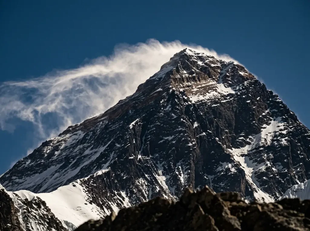
The official height is 8,848.86 meters (29,031.7 feet), set by the 2020 joint survey by Nepal and China that settled the number. That sounds tidy. It was anything but tidy for decades, because two governments published two different heights for the same rock, and both of them were right.
The number that finally stuck
Before 2020, Nepal and China didn’t agree, and the gap wasn’t a rounding error. The fix took GPS receivers carried to the actual summit plus ground-penetrating radar to measure the snow depth on top. Once both countries signed off on the same method, 8,848.86 meters became the figure everyone now quotes. It’s less a correction than a peace treaty between two surveys.
Snow cap versus bare rock, and why two countries disagreed
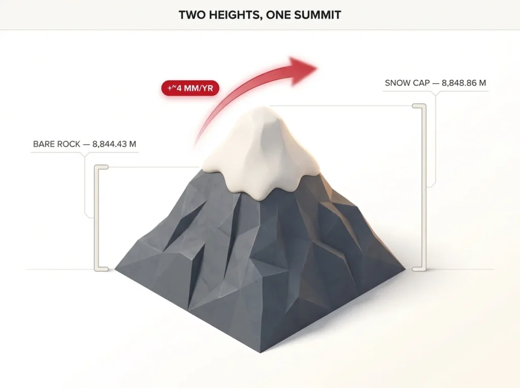
Here’s the part nobody explains cleanly. China measured the bare rock summit at 8,844.43 meters. Nepal measured the snow cap sitting on that rock at 8,848 meters. They weren’t arguing about the mountain, they were measuring two different surfaces, snow versus stone. The 2020 survey reconciled the two by measuring both the rock and the snow on top of it, which is why the agreed number is a touch higher than either old one.
A summit that won’t hold still
Everest is also taller this year than last, by a hair. The Indian Plate keeps shoving into Eurasia, and the ongoing plate collision the USGS credits for pushing the whole Himalaya skyward lifts the summit roughly 4 millimeters a year once you subtract erosion. So the highest international border on Earth isn’t a fixed point. It’s a line that’s slowly creeping upward, which is a strange thing to picture and a true one.
When a trivia answer insists Everest is exactly 8,848 meters or exactly 29,029 feet, it’s quoting an older survey. The current agreed figure is 8,848.86 meters. Both numbers float around online, so the decimals tell you which era a source is stuck in.
Worth saying plainly: the highest mountain and the hardest mountain to climb aren’t the same peak. Everest wins on altitude. It doesn’t win on technical difficulty, and the climbers who’ve done both will tell you so without much prompting.
How to Actually Spot Everest on a Map and From the Ground
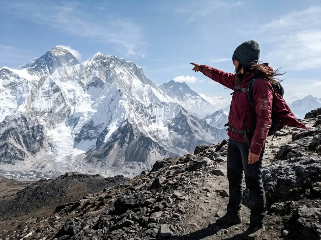
This is the part the trekking-blog clones skip, and it’s the one that actually trips people up. Everest does not announce itself. From most places you can stand, it is not the obvious giant on the horizon, and plenty of people photograph the wrong mountain without ever knowing it.
Why Everest doesn’t look like the tallest peak
Drop those coordinates into Google Earth and look at the terrain around the pin. Everest sits set back behind a long wall formed by Nuptse and Lhotse. Because it’s further from most viewpoints and partly screened by closer peaks, it reads as smaller than neighbors that are actually shorter. Distance and a nearer ridge will fool your eye every time.
Base Camp won’t show you the summit, Kala Patthar will
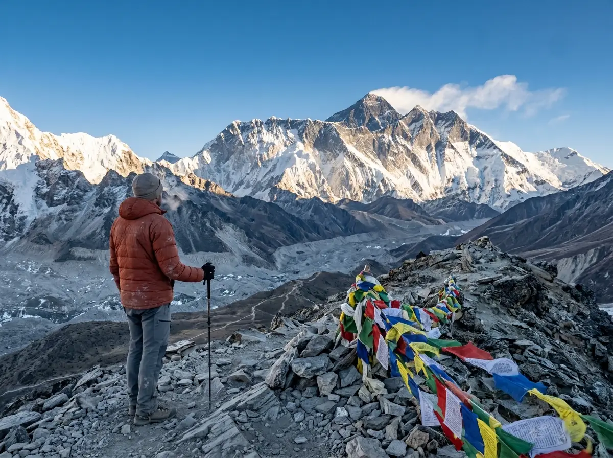
Here’s the letdown that catches first-timers. From Everest Base Camp, you cannot see the summit at all. Nuptse, at 7,861 meters, stands directly in the way. People walk for over a week to reach Base Camp, look up, and the mountain in front of them isn’t even Everest. The classic unobstructed view comes from Kala Patthar, a roughly 5,545-meter shoulder on Pumori, which is the short, lung-burning hike that produces nearly every postcard summit shot you’ve ever seen. If you want a sense of what the trek in actually looks like once you’re standing in the Khumbu, that hidden-summit moment is a big part of it.
How to pick Everest out of the wall of giants
The trick is to stop looking for the nearest big face. Look instead for the dark summit pyramid set behind the long Nuptse–Lhotse ridgeline, usually with a thin banner of blown snow streaming off the top. That back-row pyramid is Everest. The bright, close, dramatic wall in front is Nuptse doing its usual job of stealing the photo.
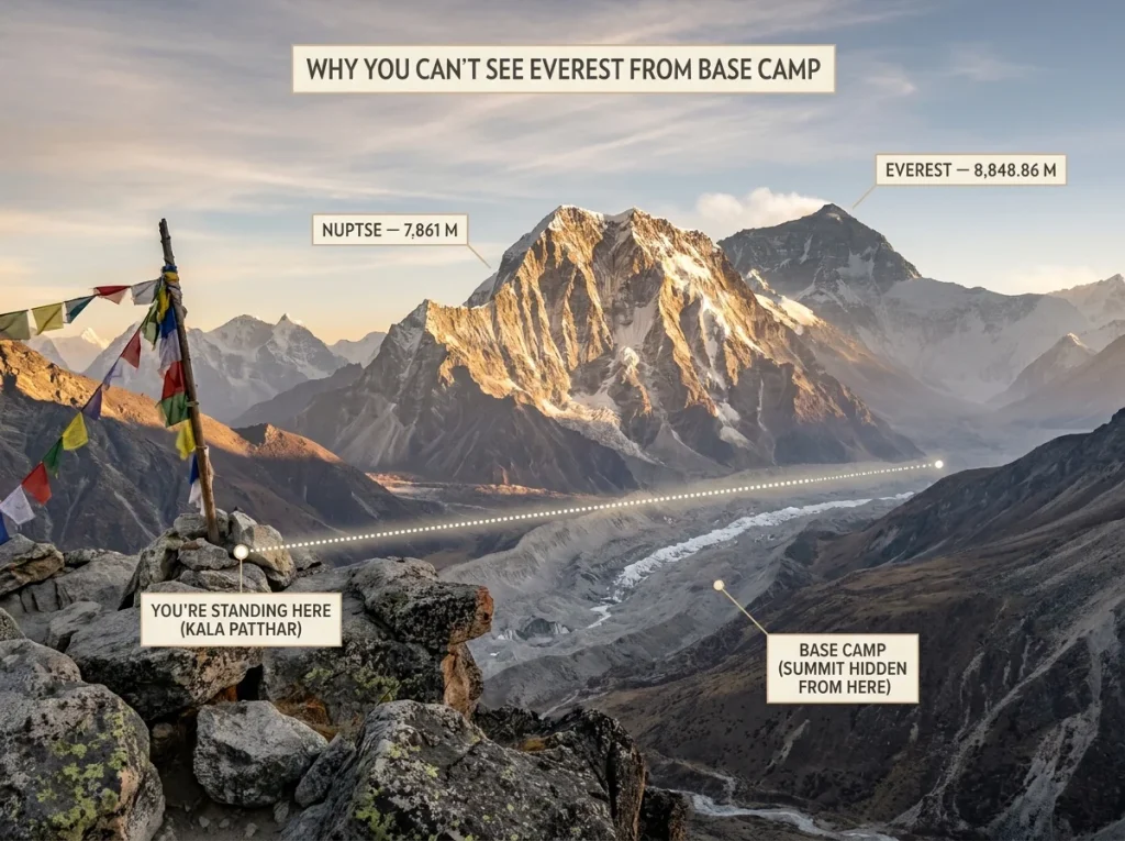
Next time a friend shows you their “Everest” photo from the Khumbu, check the back row. If the tallest-looking peak is front and center and sharply lit, it’s almost certainly Nuptse. Everest is the quieter dark pyramid behind it.
South Side or North Side, What the Border Split Means
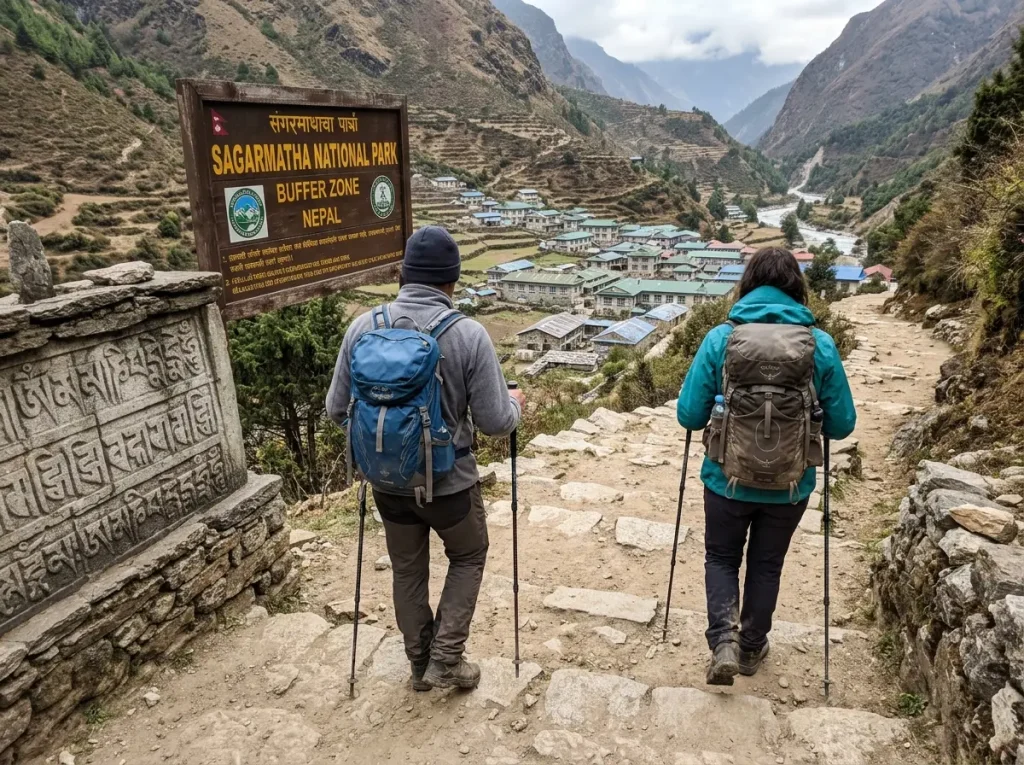
The border isn’t just trivia. If you ever go, the slope you choose decides which country you deal with, which permit you buy, and how you even get to the foot of the mountain. Pick your side first, because the country dictates the whole chain after that.
The Nepal side (south): Sagarmatha, Lukla, the trek
The south side sits in Nepal’s Solukhumbu District, inside Sagarmatha National Park, the UNESCO World Heritage site that protects the Nepal slope. You fly from Kathmandu to Lukla, then walk for roughly 8 to 14 days through Namche Bazaar and up the valley. It runs on a national-park permit plus a trekker registration, and the whole approach is on foot. No road delivers you to Base Camp on this side. The standard climbing line from here is the Southeast Ridge, the route Tenzing Norgay and Edmund Hillary took on the 1953 first ascent.
The Tibet side (north): Tingri, the drive-in approach
The north side sits in Tingri County, in Shigatse (Xigazê) Prefecture, inside the Qomolangma National Nature Preserve in Tibet, and its standard climbing line is the Northeast Ridge. The paperwork is different, a Chinese visa plus a separate Tibet travel permit, and so is the travel style. From Lhasa you can largely drive toward the mountain, which makes the north approach faster to reach even though it’s a more controlled entry. Same summit, completely different trip. If you’re weighing it seriously, what an Everest expedition actually costs once you’ve picked a side shifts a lot depending on north versus south.
Sagarmatha, Chomolungma, Everest, the names by side
The mountain had names long before a British surveyor’s stuck. In Nepal it’s Sagarmatha; in Tibet it’s Chomolungma (also written Qomolangma). “Everest” came from the 1865 Survey of India, which first logged the mountain under the plain catalog label Peak XV before swapping in the surveyor’s name. Which name a source leads with often tells you which side of the border the writer is standing on, and learning all three signals you know the mountain is older than its English label.
If a guidebook or operator keeps saying Chomolungma and quoting drive times from Lhasa, it’s describing the Tibet north side. If it’s all Sagarmatha, Lukla flights, and teahouse trekking, it’s the Nepal south side. The vocabulary gives away the route before the itinerary does.
Is Mount Everest in India? Clearing Up the Mix-Up
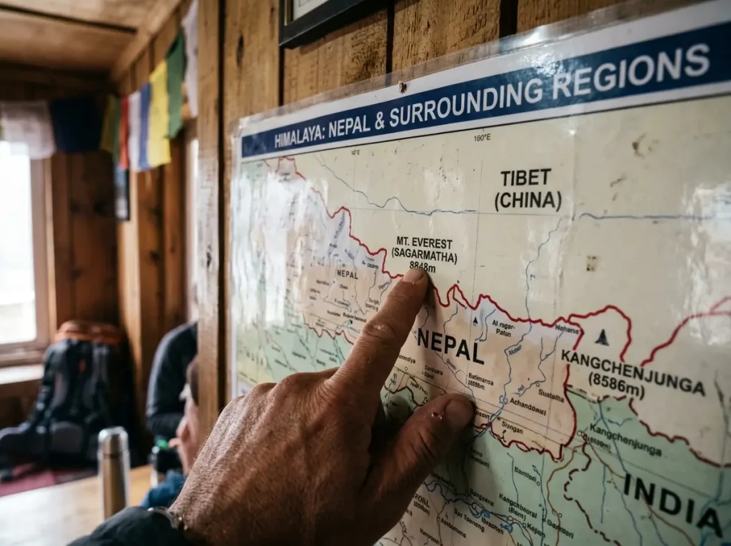
Of all the wrong answers, India is the most common and the most forgivable. It comes from two real things colliding, geography and history, and once you see them the mistake makes sense even though it’s still a mistake.
Why people guess India
The Himalayas don’t belong to one country. They span India, Nepal, China, Bhutan, and Pakistan, and India’s slice is large and famous. If your mental map says “Himalayas equals India,” Everest gets filed there by default. It’s a reasonable shortcut that happens to land in the wrong place.
The George Everest naming twist
History pours fuel on it. The peak was measured and named by the 19th-century Great Trigonometrical Survey of India that first fixed its height and its English name, and it was named for George Everest, a former Surveyor General of India. So the mountain carries an Indian-survey name even though the summit isn’t on Indian ground. An Indian name on a non-Indian peak is practically built to mislead.
What India actually has (and doesn’t)
India has serious Himalayan terrain and serious peaks. Kangchenjunga, the third-highest mountain on Earth, sits on the India–Nepal border. What India does not have is Everest. The summit is strictly on the Nepal–Tibet line, and India’s nearest high Himalaya, in Sikkim and Uttarakhand, lies well to the east and west of it. Close neighbor, wrong country.
The Cities, Airports, and Peaks Around Everest
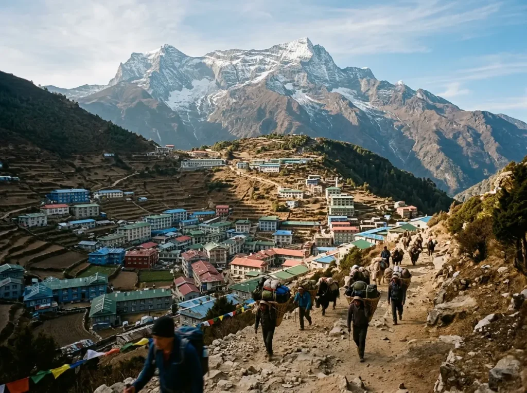
Nobody starts at the mountain. Everest sits deep in a roadless stretch of high country, so getting near it means a chain of stops, and knowing that chain is half of knowing where the mountain really is.
Nepal-side gateways, Kathmandu, Lukla, Namche
On the Nepal side it goes capital, airstrip, town, then your own two feet. Kathmandu is the gateway city, about 160 kilometers from the mountain in a straight line. From there you fly to Lukla, whose Tenzing-Hillary Airport sits at 2,860 meters and only about 30 kilometers from Everest as the crow flies. Lukla is the real trailhead. From it you walk, climbing through Namche Bazaar, the busy Sherpa trading town that acts as the unofficial capital of the Khumbu, and keep going for over a week.
Tibet-side staging, Lhasa and Tingri
On the north side the staging points are Lhasa, the Tibetan capital, and then Tingri, the last real town before the mountain. Because a road runs much of the way, the Tibet approach trades the long walk-in for a long drive, which is one more way the two sides feel like separate expeditions to the same summit.
The wall of giants next door
Everest doesn’t stand alone, and that’s exactly why it’s hard to single out. Lhotse, the fourth-highest peak on the planet, is joined to Everest by the high saddle of the South Col. Nuptse screens it from the south. Makalu, Cho Oyu, and the spire of Ama Dablam fill out the skyline nearby, including Cho Oyu, the 8,000-meter peak next door on the same Nepal–Tibet border. Everest is really one entry in a whole roster of famous mountain peaks and what each one demands, and seeing it in that company is the fastest way to understand why it gets lost in the crowd.
Conclusion
So, where is Mount Everest? On the Nepal–Tibet (China) border, in the Mahalangur Himal of the Himalayas, in both countries at once and not in India. It stands 8,848.86 meters tall, a height that two governments only agreed on in 2020, and the summit is still inching upward every year. The part most people never hear is that it hides behind Nuptse, so the real view comes from Kala Patthar, not from Base Camp.
Next time you see an “Everest” photo, check the back row before you take the caption’s word for it. And if you ever catch yourself map-dreaming a trip, pick your side first, because Nepal and Tibet are two different mountains wearing the same summit.
Frequently Asked Questions
01Is Mount Everest in Nepal or China?
Both. The China–Nepal border runs across the summit, so the south slope is in Nepal and the north slope is in Tibet, China. Climbers usually say south side or north side instead of naming a country.
02Is Mount Everest in India?
No. Everest sits strictly on the Nepal–Tibet (China) border. The confusion comes from the India-spanning Himalayas and the British Survey of India that named the peak. India’s Kangchenjunga is its closest comparison, not Everest.
03What mountain range is Mount Everest in?
The Himalayas, and more precisely the Mahalangur Himal sub-range. That pocket also holds Lhotse, Nuptse, Makalu, and Cho Oyu, which is why Everest is hard to pick out from a distance.
04How tall is Mount Everest and how was it measured?
It stands 8,848.86 meters (29,031.7 feet), agreed by a 2020 joint Nepal–China survey using summit GPS and ground-penetrating radar. Earlier figures differed because China measured bare rock and Nepal measured the snow cap.
05What is the closest city or town to Mount Everest?
On the Nepal side, Kathmandu is the gateway city and Lukla is the nearest airstrip, with Namche Bazaar the last real town. On the Tibet side, Lhasa and then Tingri are the staging points.
Safety Notice: Rock climbing and mountaineering are inherently high-risk
activities that can involve physical trauma or fatal incidents. The information on Rock Climbing Realms is for
educational and informational purposes only. Techniques and advice presented here are not a substitute
for professional, hands-on instruction. Conditions and risks vary by location. Always seek guidance
from a qualified instructor before attempting new techniques. By using this website, you agree that you
are solely responsible for your own safety. Any reliance you place on this information is strictly
at your own risk, and you assume all liability for your actions. Rock Climbing Realms and its authors
will not be held liable for any harm, damage, or loss sustained in connection with the use of this information.
Affiliate Disclosure: We are a participant in the Amazon Services LLC Associates Program, an
affiliate advertising program designed to provide a means for us to earn advertising fees by advertising and linking
to Amazon.com. As an Amazon Associate, we earn from qualifying purchases. We are also an official affiliate partner
of Black Diamond Equipment via the AvantLink network. If you click on a Black Diamond affiliate link and make a
purchase, we may earn a commission at no additional cost to you. We also participate in other affiliate programs.
Additional terms are found in the terms of service.