In this article
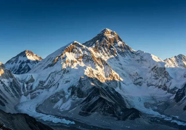
The reputation of Mount Everest as the world’s highest peak is just the beginning of its story. While its superlative height is a key fact, to truly understand the answer to “mount everest where is it?,” we must look beyond a simple map pin. This article explores the mountain‘s location through the lens of geopolitics, culture, and geology, providing the comprehensive context a dedicated climber or adventurer seeks. We’ll pinpoint its exact coordinates on the Nepal-China border, explore the two primary access points from either nation, and delve into the immense geological forces that created this titan, revealing its dual names—Sagarmatha and Qomolangma—as gateways to its rich narrative and its place in mount everest in popular culture.
Pinpointing the Peak: Where Exactly is Mount Everest?
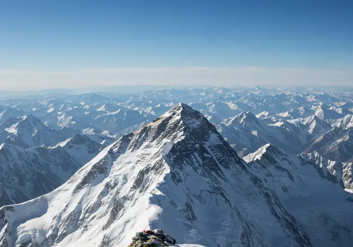
Answering the core question of Everest’s location requires moving from the continental scale down to the specific international border the peak straddles. We’ll provide precise, layered geographical information that leaves no ambiguity about its physical place on the globe—a location defined not by lines on a map, but as a frontier of culture, geology, and human ambition within the mighty Himalayas.
A Mountain of Two Nations: The Nepal-Tibet Border
Mt. Everest is located precisely on the international border separating Nepal to the south from the Tibet Autonomous Region of China to the north. The summit itself is perfectly bisected by this boundary, making Everest, Mount a uniquely shared peak between the two countries. This shared ownership is a critical geopolitical reality that dictates everything from mountaineering regulations to international relations for anyone planning a Mount Everest expedition.
On the Nepal side, the mountain falls within the Solukhumbu District of Koshi Province. This area, famously known as the Everest region, is the homeland of the Nepali Sherpa climber community and is protected within Sagarmatha National Park, a UNESCO World Heritage site. To the north, Everest is situated in Tingri County, part of the Xigazê prefecture in the Tibet Autonomous Region, China. Here, the landscape is defined by the high, arid Tibetan Plateau and is protected by the vast Qomolangma National Nature Preserve.
The formal definition of this shared summit was solidified by the 1960 Sino-Nepalese Border Agreement, which established that the boundary line runs directly through the highest point. This foundational treaty, named after Sir George Everest, mandates the dual administration of the mountain, requiring climbers to secure permits from the respective country they plan to ascend from.
The Himalayan Titan: Everest’s Place in the World
Geographically, Mount Everest is situated in the Mahalangur Himal sub-range of the Himalayas. This specific sub-range of the Himalayan mountain range is a true fortress of giants, containing four of the world’s six highest Himalayan peaks: Everest, Lhotse, Makalu, and Cho Oyu. For mountaineers, understanding this density of high-altitude objectives is key, as no other region on Earth presents such a concentration of formidable mountains.
The mountain itself is shaped like a three-sided pyramid, often called the summit pyramid. The North and East Faces rise within Tibet, while the Southwest Face ascends from Nepal. These massive geological features define the primary climbing routes and the distinct challenges associated with each approach. The formation of Everest is the result of the immense geological pressure from the ongoing collision between the Indian and Eurasian tectonic plates, a geological process that commenced approximately 50 million years ago that defines the geology of the Himalayas.
This continental collision folded and thrust the Earth’s crust skyward, creating the entire Himalayan range results. The mountain remains geologically active, with its Himalayan leucogranite core growing by several millimeters each year. Furthermore, the meltwater from Everest’s vast glaciers, like the Khumbu Glacier and the Rongbuk Glacier, feeds wild mountain rivers that historically carved the natural access corridors for expeditions.
By the Numbers: Official Height and Coordinates
The official elevation of Mount Everest is 8,848.86 meters (29,031.7 feet) above sea level. This full elevation, which includes the snow/ice elevation over the rock summit, was jointly announced by Nepali and Chinese authorities in December 2020. This represented a significant moment of bilateral scientific cooperation that resolved previous minor discrepancies.
The precise geographical coordinates for the summit of the highest mountain in the world are widely accepted as 27°59′18″N latitude and 86°55′31″E longitude. These coordinates are vital for modern navigation, aviation, and scientific research. Historically, determining this height was a monumental challenge for surveyors like George Everest. Early calculations were made from over 100 miles away, accounting for light refraction and Earth’s curvature.
Due to constant tectonic uplift, the mountain is not static. It continues to grow at a rate of about 2 to 4 millimeters per year while also shifting its summit northeastwards. Therefore, its official height is merely a snapshot in geological time, a figure that demands periodic re-measurement as the giant continues its slow journey upward.
The Gateways to the Summit: Nepal vs. Tibet Base Camps
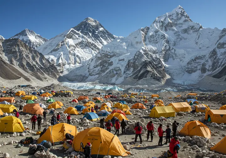
The journey to Everest extends beyond its geographical coordinates to the practical starting points for any trek or climb. The two Everest base camps are a key component of the mountain’s location, and understanding them provides actionable information for anyone planning a journey, whether for trekking or a full-blown summit attempt.
The Classic Trek: Reaching South Base Camp (Nepal)
The Everest South Base Camp in Nepal, located at an altitude of approximately 5,364 meters (17,598 feet), is the more famous of the two gateways. This well-established Everest base serves as the starting point for the historic South Col route, pioneered by Tenzing Norgay and Sir Edmund Hillary. Access for the base camp trek typically begins with a dramatic flight from Kathmandu to the Tenzing-Hillary Airport in Lukla.
From Lukla, reaching the base camp requires a multi-day trek of about 53-65 km, usually taking 7-9 days. This iconic trek, which is the start of the Everest Marathon for the truly ambitious, is a profound cultural experience, passing through Sherpa villages and past ancient monasteries. The gradual elevation gain and pace are essential for proper altitude acclimatisation. While the trek offers dramatic mountain vistas, Everest itself is not visible from the base camp; trekkers must climb the nearby hill of Kala Patthar (5,644 m) for the iconic panoramic view.
The tourism infrastructure is well-developed, with a network of teahouses making the journey achievable for individuals with good fitness. However, its popularity means the Himalayan trail can be very crowded during peak seasons.
The High Plateau: Accessing North Base Camp (Tibet)
The North Base Camp on the Tibet side sits at around 5,200 meters (17,060 feet). Its major advantage is the direct and spectacular, unobstructed view of Mount Everest’s North Face, making it a popular destination for tourists who wish to see the peak without a long trek.
Access from Chinese Tibet is logistically very different from Nepal. Most visitors fly into Lhasa, acclimatize for a few days over relatively flat terrain, and then travel overland by vehicle. A paved road leads very close to the base camp itself, making the journey much less physically demanding. The experience is defined by the vast, arid landscape of the Tibetan plateau and includes a common stop at Rongbuk Monastery, the highest in the world.
All foreign travel in Tibet must be done as part of an organized tour, as independent travel is not permitted. This requires obtaining a Tibet Travel Permit in advance through a registered agency, adding a layer of logistical restriction and pre-planning not present on the Nepal side.
Ascending the Giant: An Overview of the Climbing Routes
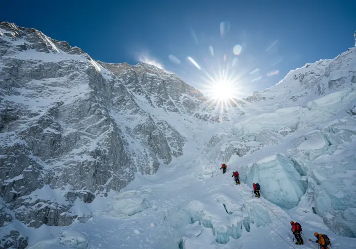
From the base camps, two primary paths lead to the summit, each with distinct challenges and characteristics. Understanding these routes is the logical next step for any dedicated climber moving from “where is it?” to “how is it climbed?”. This overview is crucial for aspiring mountaineers in the mountaineering world planning their approach.
The South Col Route: The Perilous Path from Nepal
The Southeast Ridge, or South Col route, is the most famous and historically popular path to the summit, located on the Nepalese side. Its fame is largely due to its use during the 1953 British Mount Everest expedition, which saw the first ascent of Mount Everest. The route begins at South Base Camp and immediately presents its most notorious obstacle: the Khumbu Icefall. This chaotic, constantly shifting glacier is a maze of deep crevasses and towering ice seracs.
The Icefall is considered a notoriously dangerous section and has been the site of numerous fatalities, including during the 1996 Mount Everest disaster chronicled in “Into Thin Air: A Personal Account of the Mount Everest Disaster“. Higher up, climbers face the steep Lhotse Face. This section involves traversing the “Yellow Band” and ascending the “Geneva Spur” before the final summit push from Camp IV on the windswept South Col at roughly 8,000 meters.
The route’s primary advantages include better potential for high-altitude rescue and extensive support infrastructure. However, the severe objective danger of the Khumbu Icefall and severe overcrowding, which can create dangerous bottlenecks on summit day, are its major drawbacks.
The North Col Route: The Windswept Ascent from Tibet
The Northeast Ridge, or North Col route, approaches the summit from the Tibetan side and presents a different set of challenges. It was the focus of the early 1922 and 1924 British Mount Everest expedition attempts. A key logistical benefit is that an Everest expedition can drive to Base Camp and use yaks to transport gear to Advanced Base Camp (ABC) at 6,400 meters.
The route’s greatest advantage is that it completely avoids the Khumbu Icefall. Instead, the ascent is made to the North Col and then follows the long, exposed, and often brutally windy rocky north ridge. The technical cruxes are the “Three Steps,” a series of rock barriers on the upper ridge, with the Second Step being the most formidable. The final ascent from the North is typically longer and more arduous than from the South.
While it is often less crowded, the north route has significant drawbacks. It is exposed to harsher, colder winds, and no helicopter rescues are permitted, meaning any emergency requires a land evacuation from Base Camp. Access is also subject to stricter permit regulations. A detailed look at Everest Routes Compared: South Col vs. North Col can help climbers weigh these critical factors.
Key Takeaways: Situating Everest Beyond the Map
- Shared Peak: Mt. Everest is not in a single country; its summit straddles the border of Nepal and China (Tibet), a critical fact that governs all aspects of access, climbing, and management.
- Two Gateways: The journey to Everest begins at one of two distinct locations: the South Base Camp in Nepal, reached via a classic high-altitude trek, or the more accessible North Base Camp in Tibet, which offers road access and superior views of the summit.
- Geologically Active: Located in the Mahalangur Himal sub-range of the Himalayas, Everest is a product of immense tectonic forces and is still actively rising, a dynamic giant shaped by ongoing geology.
- Route Choice is Critical: The two primary climbing routes—the South Col from Nepal and the North Col from Tibet—present a fundamental trade-off between the objective hazard of the Khumbu Icefall (South) and the extreme wind, cold, and lack of rescue options (North).
- More Than a Climb: Understanding Everest’s location requires looking “beyond the map” to the culture of the Sherpa people, the impacts of climate change, and the complex geopolitics that make it a powerful symbol of both human ambition and global challenges.
Frequently Asked Questions about Mount Everest’s Location
What continent and mountain range is Mount Everest in? +
Can you see Mount Everest from Kathmandu? +
Which is harder, the trek to the North or South Base Camp? +
Do you need a permit to go to Everest Base Camp? +
We are a participant in the Amazon Services LLC Associates Program, an affiliate advertising program designed to provide a means for sites to earn advertising fees by advertising and linking to Amazon.com. As an Amazon Associate I earn from qualifying purchases. We also participate in other affiliate programs. The information provided on this website is provided for entertainment purposes only. We make no representations or warranties of any kind, expressed or implied, about the completeness, accuracy, adequacy, legality, usefulness, reliability, suitability, or availability of the information, or about anything else. Any reliance you place on the information is therefore strictly at your own risk. Additional terms are found in the terms of service.


